
AEROphoria

Mission Operations
The paperwork was the hard part. Not any more.
From “Can I fly here?” to a planned mission and an audit-ready case in one guided platform. AEROphoria brings the safety map, mission planning, logbook and supporting evidence together for Australian drone operations.
Currently available only in Australia. International visitors can explore the platform here and contact UXMachines.
Plan. Fly. Analyse. Elevate.
One connected path from the first airspace check to the operational record. Built in Western Australia by UXMachines.
How It Works
From mission to evidence
01Draw the mission
Set the area, review the airspace and identify who and what is beneath the flight path.
02Answer the questions
Use a guided SORA or AusSORA assessment when the operation calls for it. See the reasoning and supporting rules.
03Keep the evidence
Connect flight records, fleet information and supporting documents to the work they support.
04Lodge it
Eligible enrolled operators can use supported CASA authorisation workflows. The relevant authority makes the decision.
05Decide
Review mission imagery and data in context where the relevant analysis module is available.
Start free. Bring your first SORA when the job demands it.
Start with the free safety app and logbook. Specialist workflows are available through the applicable plan, beta access, add-on, enrolment or tailored arrangement. Contact us to confirm the tools available for your operation.
The app is currently available only in Australia.
Features
Seven capabilities carry the whole path
Airspace and safety map
Review aerodromes, restricted and danger areas, national parks, weather and relevant map layers before a flight.
SORA / AusSORA assessment
Bring risk calculations, supporting evidence, revisions and outcomes into one structured case record.
CASA authorisation workflows
Submit and track supported requests where operator eligibility and enrolment requirements are met.
Zone authority portal
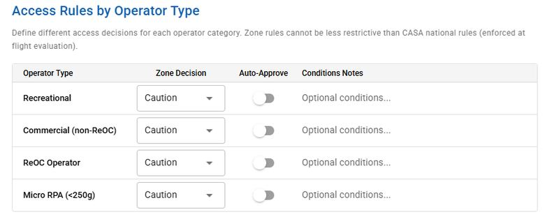
Participating zone managers can publish rules and review, approve, decline or condition operator requests.
Mission analytics and detection
Bring imagery back to the mission for annotation and analysis. Specialist modules are available on request.
Logbook, fleet and maintenance
Keep flight records alongside aircraft, equipment, maintenance and team information. Access varies by module.
Evidence and audit trail
Keep supporting documents and assessment revisions together, with results traceable to the relevant rule version.
The sky opened. The paperwork didn’t.
1,800
ReOC holders
28,000
Registered commercial drones
18%
Annual growth in commercial drone work
$1,750
Typical manually handled airspace approval cost
Market figures reproduced from the AEROphoria brochure.
01 AIRSPACE
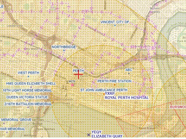
See where you can fly
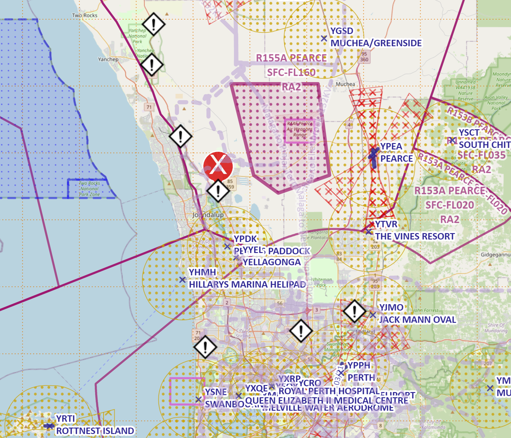
Review the airspace picture before a mission. Choose layers, inspect location details and check available weather information in AEROphoria’s drone safety app.
The map supports planning. Pilots remain responsible for checking current information, local requirements and flight conditions.
02 MISSION PLANNING
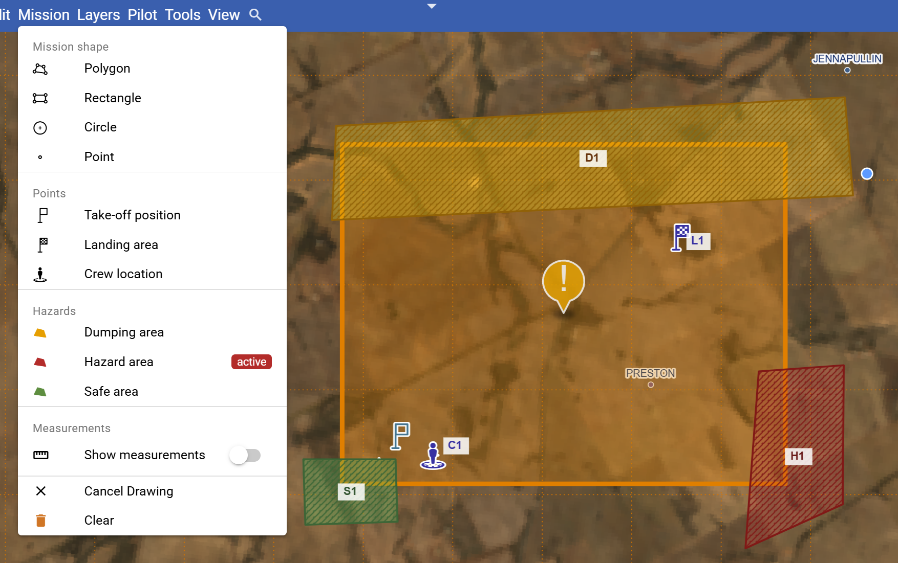
Draw the mission. Share the plan.
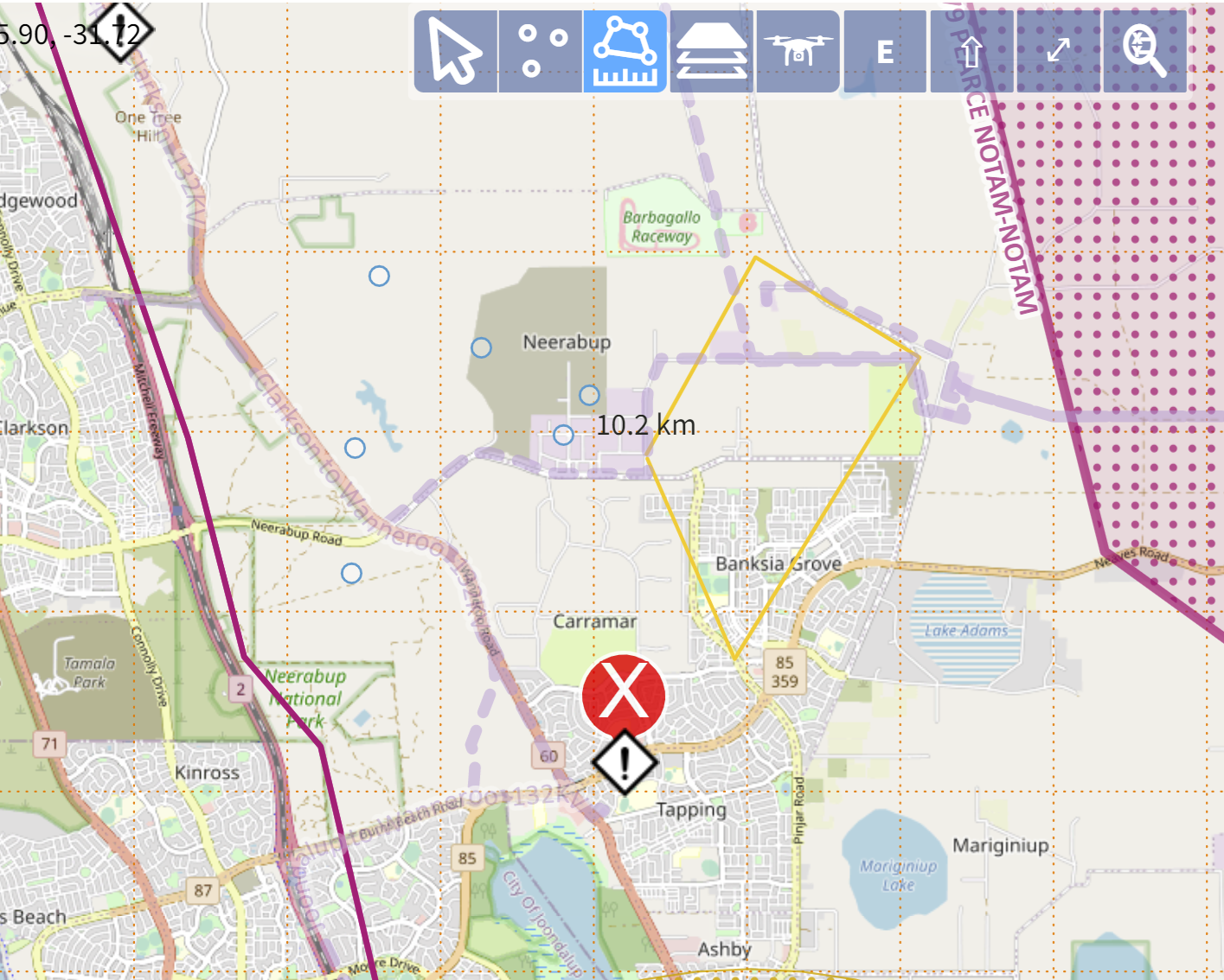
Mark mission areas, hazards, crew positions and safe locations. Keep the details that matter to the operation together so the people involved can work from a common plan.
Import, export and annotation tools support the workflow where available to your account.
03 RISK ASSESSMENT
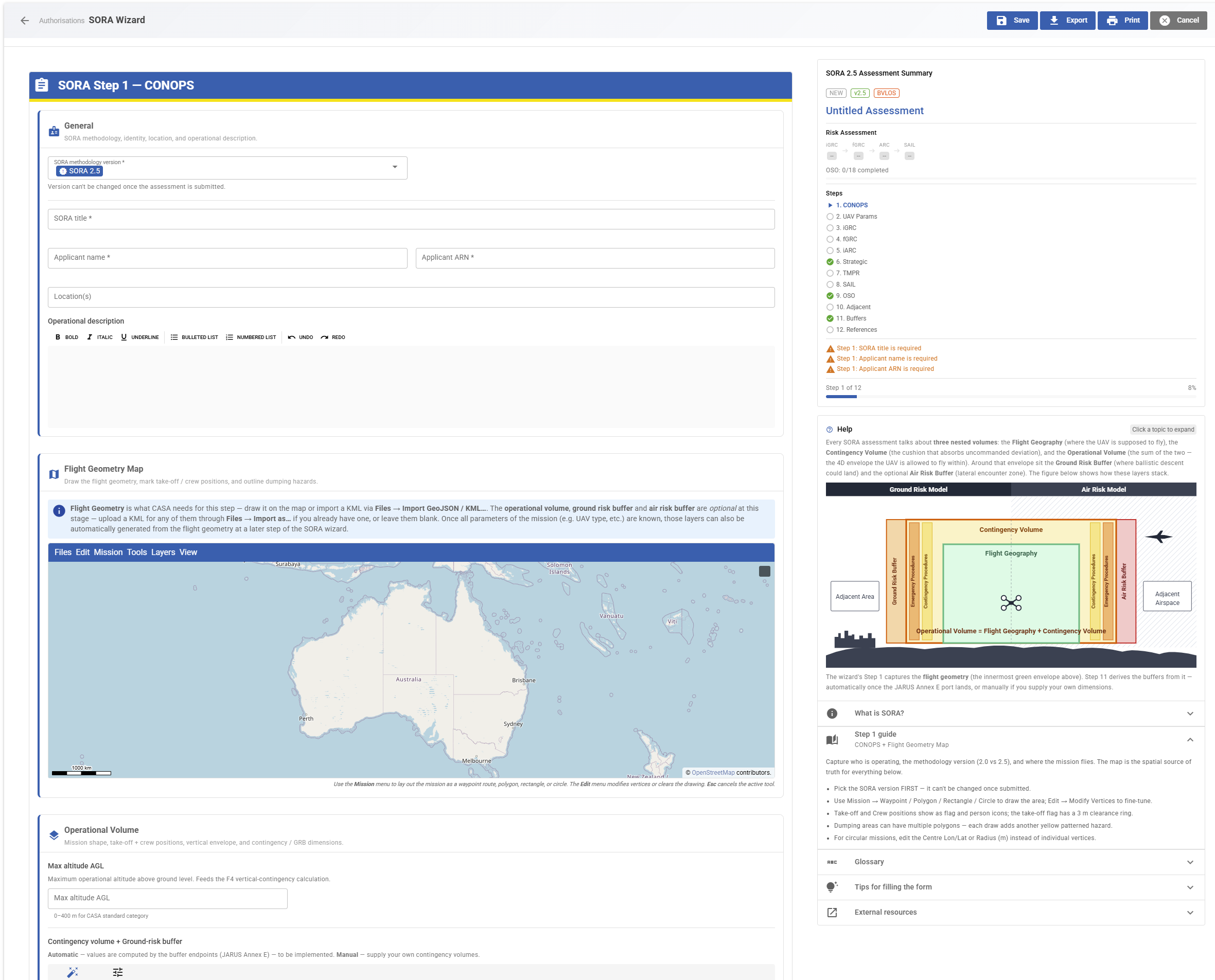
Get it approved — SORA risk assessment
AEROphoria provides structured tools for AusSORA and JARUS SORA 2.0 and 2.5 assessments. Bring risk calculations, population information, supporting evidence and case revisions into a guided workflow.
Results can be traced to the relevant rule version. Assessment and authorisation tools support your application; decisions rest with the relevant authority.
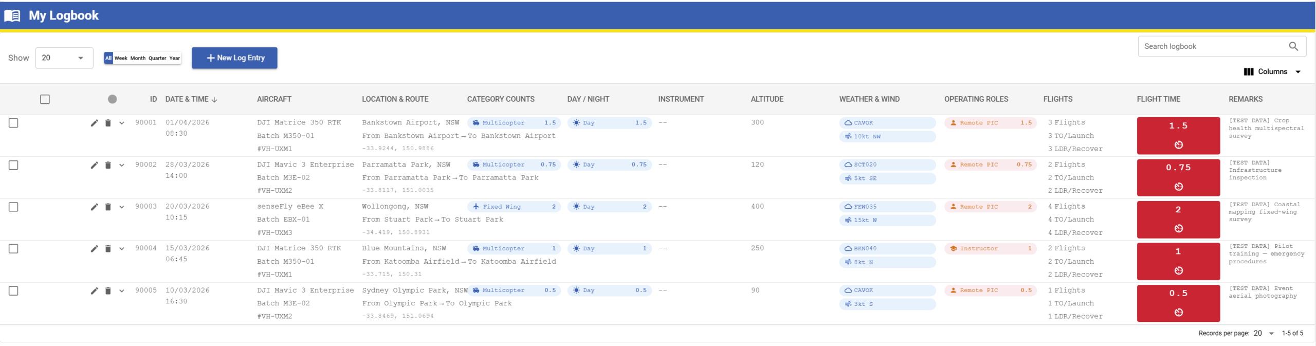
04 OPERATIONAL RECORDS
Keep the record with the operation
Record the aircraft, mission, flying time and outcome in a digital logbook. Connect this with equipment records, maintenance and organisation tools as your operation grows.
Some operational modules are being introduced through beta access or tailored arrangements.
05 MANAGED ZONES
Built for the authority you answer to
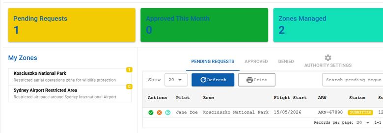
For participating managed zones, operators can submit permit requests with supporting documents and keep the conditions alongside the request.
Zone managers can publish access rules and decide requests through their own portal. These permissions are distinct from CASA automated airspace authorisations.
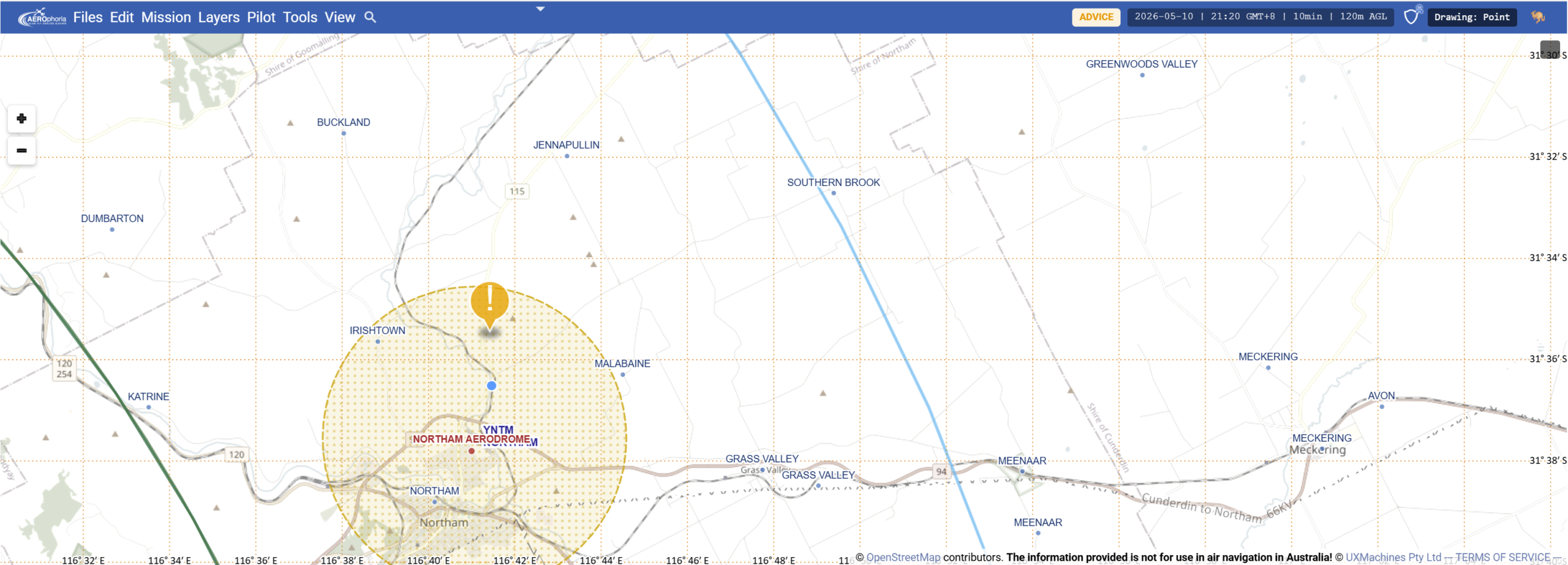
A closer look at the map
Explore the airspace picture and measure a mission area. Select either screenshot to view it at full size.
A platform for different kinds of pilots
Recreational pilots
Start with the free safety map, flight information and logbook.
Commercial pilots and ReOC teams
Bring mission planning, flight records and operational information into a shared workflow.
Advanced operations
Ask about SORA, authorisation, imagery and other specialist modules for more complex missions.
Good To Know
Frequently asked questions
Why is it called AEROphoria?
AEROphoria combines “AERO” for aviation with “phoria,” inspired by “euphoria” — a feeling of excitement or happiness. The name expresses our enthusiasm for aviation and the possibilities of drone technology. If you first read it as “aerophobia,” think of it as the opposite: a shared enthusiasm for flying.
Why do release names end in “-up”?
We name AEROphoria releases after Western Australian towns ending in “-up,” including Karrinyup, Tambellup and Quinninup. It is a way of celebrating our Western Australian roots and connecting each release with a local place. Some town names end in “-nup,” but the shared ending used for the release naming tradition is “-up.”
Is AEROphoria free?
The core drone safety app and logbook are available free. Advanced operational features may require beta access, an add-on or another plan. Contact UXMachines for current availability and pricing.
Can I use the app outside Australia?
Not at this stage. AEROphoria is currently accessible only from Australia. International visitors can explore its capabilities on this page and contact UXMachines about their needs.
Is AEROphoria part of CASA or Airservices Australia?
No. AEROphoria is independently developed by UXMachines. Participation in CASA’s drone safety app and authorisation programs does not mean CASA or Airservices owns or endorses the product.
Can AEROphoria approve every flight?
No. AEROphoria is a planning, assessment and record-keeping platform. Supported authorisation workflows are available only to eligible enrolled operators and for supported operations. Decisions rest with the relevant authority, and the operator remains responsible for a safe and lawful flight.
Does the map show every nearby aircraft?
No. Where community-supplied aircraft-position data is displayed, coverage is incomplete, especially for low-flying aircraft. An empty map does not mean the airspace is clear. This information supports situational awareness and is not an authoritative source for flight decisions or regulatory submissions.
Which features are available now?
The platform is being developed in stages. Core tools, beta modules, specialist add-ons and enterprise arrangements have different access requirements. Ask UXMachines to confirm what is available for your intended operation. Extended datasets, deeper BVLOS workflows, autonomy and Drone-in-a-Box integration, and additional authority connections are development directions, rather than current feature promises.
Our Story
Built by UXMachines
AEROphoria grew from our own need to plan and document UAV operations. Our team develops the platform in Western Australia, combining software development with experience operating drones in the field.
Downloads
Brochures
Explore the platform in our product brochure, or browse the earlier flyer in the archive.
The Old PDF is a historical flyer from 2024. Its descriptions reflect the product at that time.